Service ItemId: 816f3941aed543d3884a2c4ec3d732b3
Has Versioned Data: false
Max Record Count: 2000
Supported query Formats: JSON
Supports applyEdits with GlobalIds: False
Supports Shared Templates: False
All Layers and Tables
Layers:
Description: 2010-2017 Vessel Monitoring System (VMS) data were used from the NOAA Office of Law Enforcement to create this fishing effort dataset for the U.S. West Coast. The dataset was generated using VMS points at fishing speeds to create fishing tracks. Tracks were joined to the BOEM aliquot grid (1.2x1.2 km) to create heat maps of fishing effort for various fisheries based on individual and combined declaration codes.
Click HERE for a full description of the methodology used to create these data.
Click HERE for full metadata details.
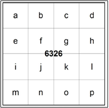
Outer Continental Shelf (OCS) Aliquots are a subdivision of the offshore marine OCS Blocks and divided into 16 equal parts for Renewable Energy leasing purposes. A metric OCS Aliquot is 1200 meters square containing 144.000000 hectares and is shown here with the aliquot letter.
Copyright Text: U.S. Department of Interior (DOI) | Bureau of Ocean Energy Management (BOEM) | Pacific Region | Frank Pendleton (frank.pendleton@boem.gov) and California State Polytechnic University | Dr. Ben Ruttenberg (bruttenb@calpoly.edu)
Spatial Reference: 102100 (3857)
Initial Extent:
-
XMin: -14493781.9888539
YMin: 4977879.49870451
XMax: -13026130.5146179
YMax: 6407339.29888971
Spatial Reference: 102100 (3857)
-
XMin: -14190717.6060716
YMin: 4102650.37622484
XMax: -13422951.7946671
YMax: 6174783.23285468
Spatial Reference: 102100 (3857)
Child Resources: Info
Supported Operations: Query ConvertFormat Get Estimates Create Replica